Date: 09/21/2010
Description: Alice Lake, Twin Lakes, Snowyside Pass
Region: Off of Highway 75, ~20 miles south of Stanley, ID.
Companions: Jasper
Distance: 16.4 miles
Elevation Gain: 2494 ft
High Point: 9490 ft
I have been chipping away at this for awhile: selecting and editing photos from my best week of Summer 2010, possibly the entire year. Just me, puppyman, the road and the trail. Perfection. Our destination was the Sawtooth Wilderness in Idaho.
We drove to Bullfrog Lake Campground on Highway 21 the first day, a distance of just about 600 miles; a truly beautiful and epic drive. We woke up with the sun, as I can not help from doing while camping, and drove over a 7000 foot pass and down to Stanley, ID.
Stanley is one of my top 5 favorite places I have visited. It has the scenery of Jackson, WY without all the snobby a-holes. It has only what it needs: a couple lodges and gear shops, one general store and one hell of a burger joint/bar.
What else do you really need?
 Our tent on wheels outside of Stanley, ID with the Sawtooth Range behind.
 Jasper's tongue: Pure Madness.
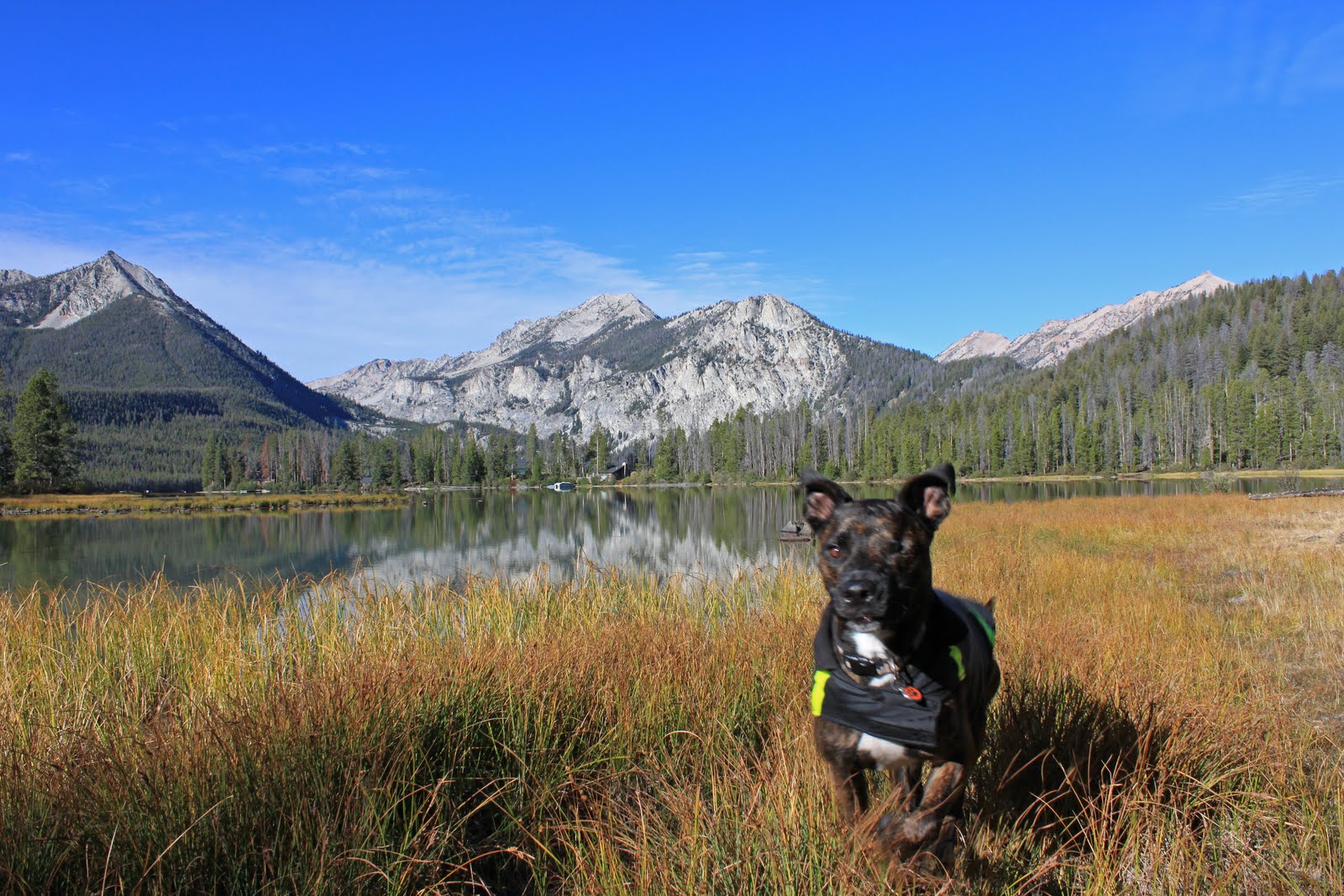
After a brief tour through town, we drove to the Pettit Lake Campground, which is also a major trailhead into the Wilderness, and started on our hike. Destination: Snowyside Pass.
 Jasper at Pettit Lake, elevation 6996. This one always makes me laugh because it was almost an awesome shot; he had been sitting looking at the camera only seconds before he saw something behind me that demanded his attention.
 The trail heading towards Snowyside Pass passes underneath a shoulder of Parks Peak.
 Looking back towards Highway 75 in the Salmon River Valley with the White Cloud Range in the distance.
 View of the ridge leading towards Parks Peak.
 View of Parks Peak summit, 10,208'.


Description: Alice Lake, Twin Lakes, Snowyside Pass
Region: Off of Highway 75, ~20 miles south of Stanley, ID.
Companions: Jasper
Distance: 16.4 miles
Elevation Gain: 2494 ft
High Point: 9490 ft
I have been chipping away at this for awhile: selecting and editing photos from my best week of Summer 2010, possibly the entire year. Just me, puppyman, the road and the trail. Perfection. Our destination was the Sawtooth Wilderness in Idaho.
We drove to Bullfrog Lake Campground on Highway 21 the first day, a distance of just about 600 miles; a truly beautiful and epic drive. We woke up with the sun, as I can not help from doing while camping, and drove over a 7000 foot pass and down to Stanley, ID.
Stanley is one of my top 5 favorite places I have visited. It has the scenery of Jackson, WY without all the snobby a-holes. It has only what it needs: a couple lodges and gear shops, one general store and one hell of a burger joint/bar.
What else do you really need?


After a brief tour through town, we drove to the Pettit Lake Campground, which is also a major trailhead into the Wilderness, and started on our hike. Destination: Snowyside Pass.


After hiking just over 6 miles, we arrived at Alice Lake, elevation 8598. What a spot! It is completely surrounded by awesome ridges and peaks, the most impressive being El Capitan.

El Capitan (9901') juts into the sky above Alice Lake. The autumn colors of the foliage adjacent to the glacial rock-flour hue of the lake were amazing.

There's my boy! Jasper (plus saddlebags) at Alice Lake with a ridge of unnamed peaks behind.

Another view of Alice Lake and El Capitan.

Alice Lake.
We had a brief rest and I remember eating an apple and giving Jasper some chewy treats. We have about 2 miles to go to reach Snowyside Pass at this point. The trail passes a couple more lakes on the way.

The first of the Twin Lakes, elevation 8858.

Above the Twin Lakes, almost to Snowyside Pass.

The view of Snowyside Peak (10651') and Pass taken from the same spot as previous picture.

And here we are after just over 8 miles. Twin Lakes from Snowyside Pass, elevation 9390'. We hung out here for a while, naturally.

The view to the NW from Snowyside Pass.

Puppyman relaxing at Snowyside Pass.
We reluctantly headed for our camp at Pettit Lake after about 45 minutes at the pass. I didn't take too many pictures on the way down except for yet another shot of El Capitan.

The afternoon light gives awesome definition, the West face of El Capitan.

Next came spicy sausage pasta, fire, and whiskey. Perfect end to a perfect day. This day would have been worth the drive in itself but there are two more epic treks to come.


